AwareCA by Intterra: California’s official emergency mapping and alerts
AwareCA by Intterra is a statewide public-safety app that centralizes emergency information for Californians, providing authoritative updates and situational maps. The app delivers near-real-time incident reporting, interactive wildfire maps, and official alerting to help people decide when to evacuate or shelter. It bundles mapping tools, location-based notices, and agency-sourced incident details into one platform, aimed at residents and visitors who need timely, verifiable guidance during hazards and high-risk incidents.
What AwareCA is intended to consolidate for the public
The app functions as a single, statewide source of official incident information by integrating data from agencies such as CAL FIRE and local fire departments, a capability listed among its core integrations. That centralization is designed to replace fragmented social media feeds and multiple local alert apps, so people can consult one platform for authoritative incident status instead of piecing together disparate reports.
How the app supports timely preparedness decisions
AwareCA supplies near-real-time incident updates that are verified by first responders and issues official push notifications for nearby threats and evacuation orders, which helps users receive actionable alerts as events evolve. The combination of verified updates and push messages reduces the time between an incident change and user awareness, making it practical for households to act on official guidance during active incidents.
Who can use it and how accessible it is
The app targets residents and visitors across California and is available on Android and iOS devices, matching common mobile habits for on-the-go alerts. It supports location-based alerts for saved home and work addresses, enabling personalized notifications tied to places that matter for an individual’s safety. The developer’s statewide design provides a consistent experience across jurisdictions rather than separate local apps.
How mapping and customization shape situational understanding
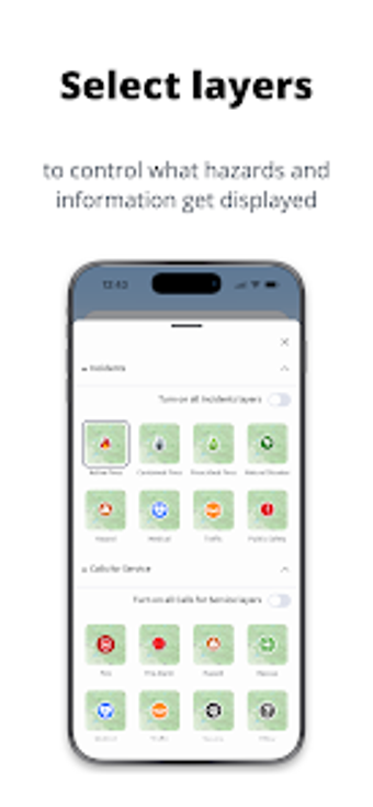
AwareCA offers interactive wildfire activity and hazard maps with optional 3D visualization to convey terrain and incident proximity, features meant to give users clearer context when assessing routes or sheltering. Users can tailor alert coverage through saved locations, and the statewide feed aims to simplify monitoring across multiple counties instead of juggling several agency channels.
A practical tool for residents who rely on official emergency information
Early app ratings and praise on major app stores indicate positive reception among initial users, which supports trust in its approach to public alerts. For household preparedness, combine the app’s notifications with a written evacuation plan and practiced meeting points so families can act quickly when an alert arrives. AwareCA suits anyone who prioritizes authoritative, mobile-first incident awareness during fire season and other emergencies.